Classic view
Duna Mayor
The great dune viewpoint
- Length919 m
- Time45-60 min
- RuleFixed direction
Locate your stop
Discover 20 stops
Pick a route, then tap a marker or a stop for notes and a Google Maps link.
The oasis town where every valley tour starts, at 2,450 m above sea level; its church on the main square dates from 1557.
Google MapsMars Valley, also called Death Valley, only 2 km from town among the dunes of the Cordillera de la Sal.
Google MapsThe sunset ridge that valley tours pair with the Kari viewpoint; local guides rate its sunsets the best around.
Google MapsThe rock formation of the Three Marys: a short walk of 15 minutes at most, with up to 24 people on the trail.
Google MapsAn old mine trail of 892 m; stay on the path, as CONAF warns of a deep shaft.
Google MapsThe Amphitheater, one of the sectors of the valley that are open for walking.
Google MapsThe great dune: CONAF gives its trail as 919 m, 45 to 60 minutes in all.
Google MapsThe viewpoint at the end of the Achache trail, which CONAF lists as 3 km and 3 hours.
Google MapsThe adobe village of Tulor, more than 3,000 years old, 10 km south-west of town on the road toward the valley.
Google MapsA hillside fortress of the Atacameno people, 3 km from the town center.
Google Maps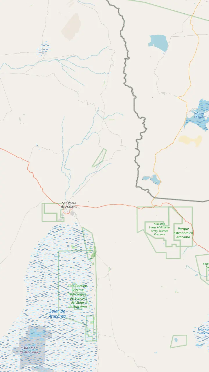
The sanctuary in the Cordillera de la Sal, protected since 1982 and part of the Los Flamencos National Reserve.
Google MapsThe oasis town where every valley tour starts, at 2,450 m above sea level; its church on the main square dates from 1557.
Google MapsMars Valley, also called Death Valley, only 2 km from town among the dunes of the Cordillera de la Sal.
Google MapsThe adobe village of Tulor, more than 3,000 years old, 10 km south-west of town on the road toward the valley.
Google MapsA hillside fortress of the Atacameno people, 3 km from the town center.
Google MapsThe volcano on the eastern skyline that you can see from anywhere in San Pedro.
Google MapsA lagoon on the Atacama Salt Flat, which covers 3000 km2 and is the largest salt flat in Chile.
Google MapsThe geyser field at more than 4,300 m, the classic dawn trip from San Pedro.
Google MapsThe plateau of the ALMA observatory, at 5,000 m, with its 66 antennas.
Google Maps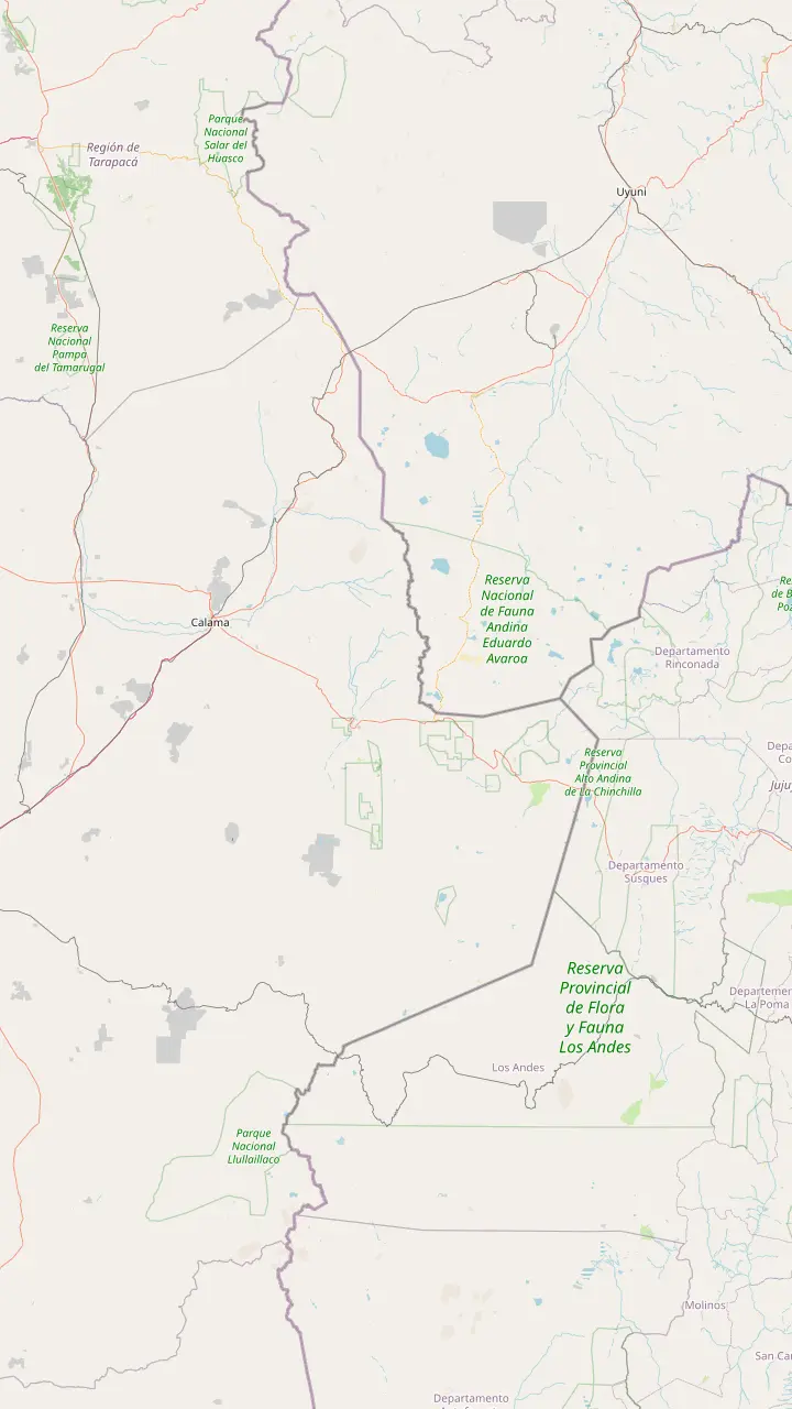
El Loa Airport, the nearest airport to San Pedro, with a terminal that stays open 24 hours a day.
Google MapsThe mining city on the far side of the desert; the valley lies 110 km to its south-east.
Google MapsThe oasis town where every valley tour starts, at 2,450 m above sea level; its church on the main square dates from 1557.
Google MapsThe bus station on the edge of town; CONAF notes that public transport links Calama with San Pedro.
Google MapsThe sanctuary in the Cordillera de la Sal, protected since 1982 and part of the Los Flamencos National Reserve.
Google MapsThe volcano on the eastern skyline that you can see from anywhere in San Pedro.
Google MapsThe Bolivian border post above town, open only to small vehicles and minibuses, at 4,549 m.
Google MapsThe crossing to Argentina at more than 4,300 m, whose nearest towns are San Pedro and Calama.
Google MapsMap © OpenStreetMap contributors
The valley starts a short drive west of San Pedro, but inside it is a string of separate trails with their own rules. Here is the road in, the order of the stops, how long each walk takes and which ones the tours visit.
Editorial team, valledelalunatour.quest · Updated November 12, 2026 · Read in 7 min
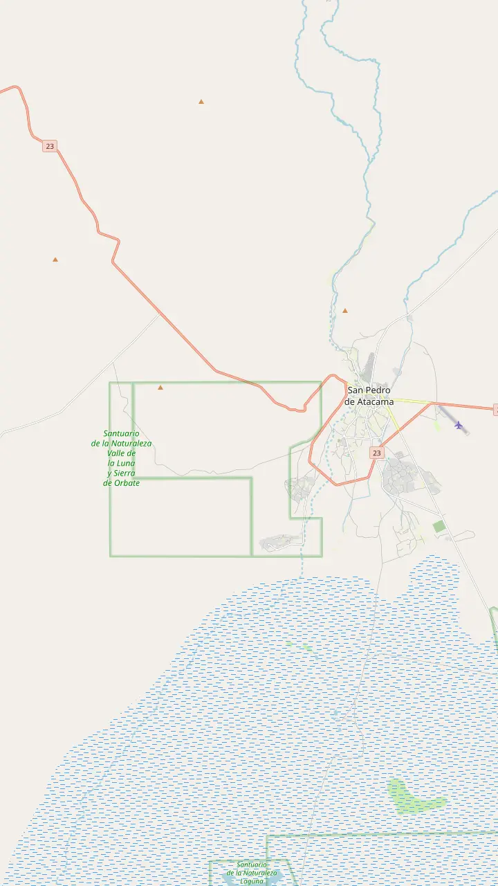
Where is Valle de la Luna, exactly? The communities that manage the gate place it in the Cordillera de la Sal, at 13 km to the west of San Pedro and 110 km south-east of Calama, in Chile's Antofagasta region.5 It is a sector of the Los Flamencos National Reserve, and CONAF lists it as sector 6, reached on secondary road 23-CH.6
On a map the valley is a band of pale, folded ridges between the town's oasis and the open desert. Its edges are close enough to see from San Pedro, yet once you are inside, the town disappears behind the walls of salt and clay. Chile Travel's attraction page gives 15 km on Route 23,7 while the same site puts the access at 13 km, which is the figure to use for the gate.1
Several places around the world share the name, so be sure of the one you mean. The valley on this site is the Chilean valley, inside the reserve near San Pedro, protected as a nature sanctuary since 1982.8 Check the country and the town in any listing before you book.
Trail by trail
| Trail | Length | Time | Watch for |
|---|---|---|---|
| Tres Marias | 80 m | 30 min | Up to 24 people |
| Mina Victoria | 892 m | 45-60 min | Deep mine shaft |
| Duna Mayor | 919 m | 45-60 min | Up to 10 min at the top |
| Cornisa | 718 m | 45-60 min | Rockfall, dusty wind |
| Achache | 3 km | 3 hrs | Heat on a long walk |
| Ckary viewpoint | 350 m | 40 min | 60 min per group |
Lengths and times from CONAF; group limits from Chile Travel's visitor guide.20,17,16,18,4,19,21,22,23
Leave town heading west on the road to Calama. Chile Travel puts the valley access 13 km away: a 15-minute drive, or 40 minutes in the saddle.1 The way passes the turn for the adobe village of Tulor, 10 km south-west of San Pedro,9 which Chile Travel suggests visiting on the way to the valley.10 The road is paved and flat, with wide views of the salt range ahead.
At the gate the rules are simple and strict. You cannot enter on foot; CONAF requires a vehicle, whether a bicycle, motorbike, car or pickup.2 Tickets are sold online, at least 1 day in advance according to CONAF,11 and entry runs in groups of at most 12, with each independent group or family naming a person in charge.12,13
Cyclists have their own window. CONAF allows bicycles in from 8:00 to 11:00 in autumn and winter and from 9:00 to 11:00 in spring and summer,14 and the official ticket page requires a helmet, a reflective vest, suitable shoes and water.15 Starting early on a bike also means riding back before the afternoon heat and wind build up.
Knowing how to visit Valle de la Luna well comes down to a simple idea: you drive or ride from trailhead to trailhead, and walk only the marked sectors. CONAF measures the inner vehicle road at 11.8 km and the full visit at 4 hours,3 while Chile Travel advises keeping at least 3 or 4 hours for the valley.25 Along the road, signed parking areas mark the start of each walk.
Every walking sector has a controlled entrance. A ranger notes who you are at the start of each sector and talks you through the path,26 and the paths are clearly signposted, with crossing their limits strictly forbidden.24 Walkers may use these named sectors: Tres Marias, Mina Victoria, the Amphitheater, Duna Mayor and the Ckari viewpoint.27
The trails can close without much warning. Blowing sand in winter and summer downpours can shut them, according to CONAF,28 and leaving the paths, climbing rocks or riding down unauthorised areas is forbidden.29 Chile Travel notes that Chilla and Culpeo foxes, thrushes and harriers live in the valley,30 so keep any food sealed in your bag.
Plan your route
Choose by time, energy and the light you want.
If I have only an afternoon
Tres Marias, then the ridge
The tour sold here covers both in 4.5 hours.
If I want the big view
Duna Mayor
919 m to a viewpoint over the dune.16
If I like long walks
The Achache trail
3 km in about 3 hours.4
If I am cycling
Go in the morning
Bicycles enter only until 11:00.14
If I want the sunset
The Ckari viewpoint
The valley's last route, 60 minutes per group.23
Pick your walk
Classic view
The great dune viewpoint
Short and easy
The famous salt pillars
Most walking
The long trail
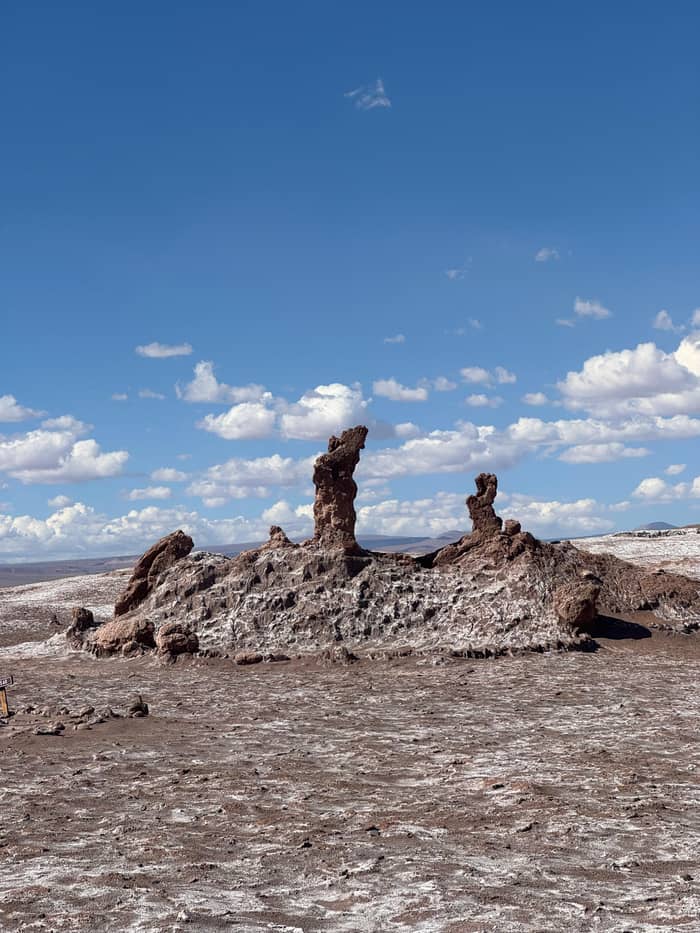
The Tres Marias are the valley's best known formation, a group of weathered salt pillars likened to praying figures. The walk to them is short: CONAF gives the trail as 80 m and 30 minutes in all,20 and Chile Travel's guide sets a maximum of 15 minutes for the walk itself, with up to 24 people on the trail.21 It is the first stop of the tour sold on this site, with a guided visit of 30 minutes.
Nearby, Mina Victoria recalls the valley's salt-mining past. Its trail is walked in a fixed direction, with a separate entrance and exit, takes up to 48 visitors at a time and lasts 30 minutes, according to Chile Travel.50 CONAF measures it at 892 m, between 45 and 60 minutes, and names the risk plainly: a long fall into a mine shaft.17 Stay on the path and keep children close here.
These western stops sit deepest in the valley, so it can make sense to reach them first and work back toward town as the afternoon goes on. That order also puts the long ridge walks in the softer light of late afternoon, and leaves the high viewpoints for the last hour before sunset. Driving yourself, note the order of parking areas on the way in so the return toward the ridge is quick.
Tours by route
Compare tours that cover different stops in the valley.
Compare 4 alternatives
Compare tours that cover different stops in the valley.
≈
View≈
View≈
View≈
ViewFrom-prices on GetYourGuide, shown at the ECB reference rate. Your exact price is confirmed during booking.
A shared tour's afternoon
Start
A short talk of 10 minutes before the valley.
First walk
A guided hike of 40 minutes to the dune viewpoint.
Middle
Shorter stops of 15, 20 and 10 minutes.
Late afternoon
A walk of 70 minutes ending with the sunset.
Evening
The van returns to the start point in San Pedro.
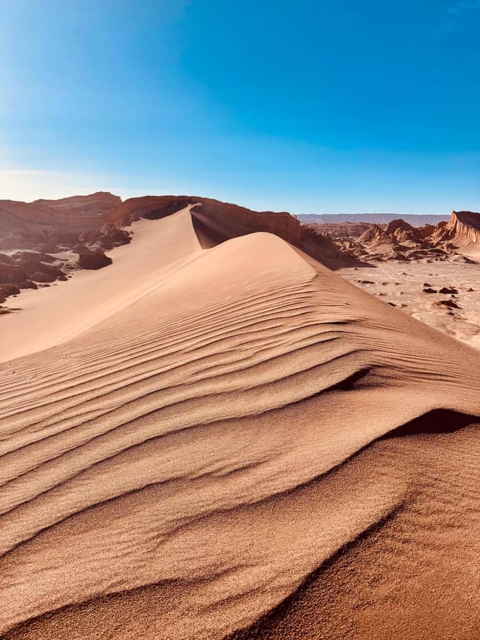
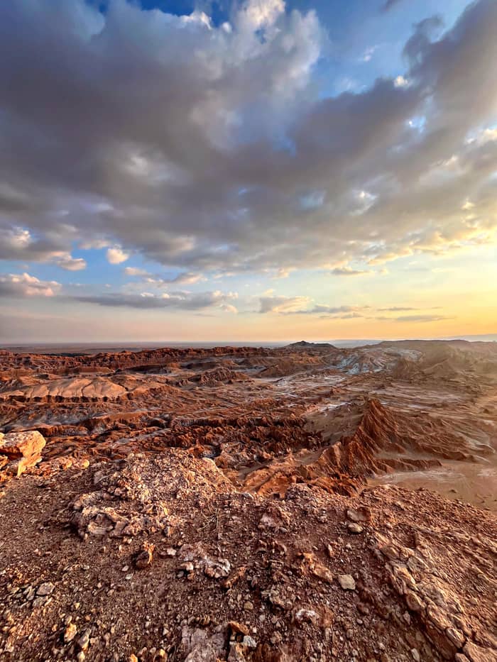
The Duna Mayor viewpoint is the walk most people remember. CONAF gives its trail as 919 m and 45 to 60 minutes, easy in summer and moderate in winter,16 and Chile Travel adds that walkers follow it in a fixed direction, with each group allowed up to 10 minutes at the top and the whole walk taking at most 40 minutes.22 From the crest you look down on the sand and across the folded ridges.
A shared valley tour builds its afternoon around this walk, with 40 minutes at Duna Mayor after a safety briefing of 10 minutes. The Amphitheater, a curved wall of eroded rock below the ridge, is another of the sectors open for walking,27 and the Cornisa trail of 718 m follows the ridge line in 45 to 60 minutes, where CONAF warns of rockfall and strong winds carrying dust.18
For a longer outing, the Achache trail is the valley's big walk: 3 km and 3 hours by CONAF's figures,4 ending at a viewpoint over the valley floor. It suits early starts on a cool day, with plenty of water. In summer, when the sun is fierce by late morning, the shorter trails are the sensible choice, and an early return beats a long walk in the glare.
Video
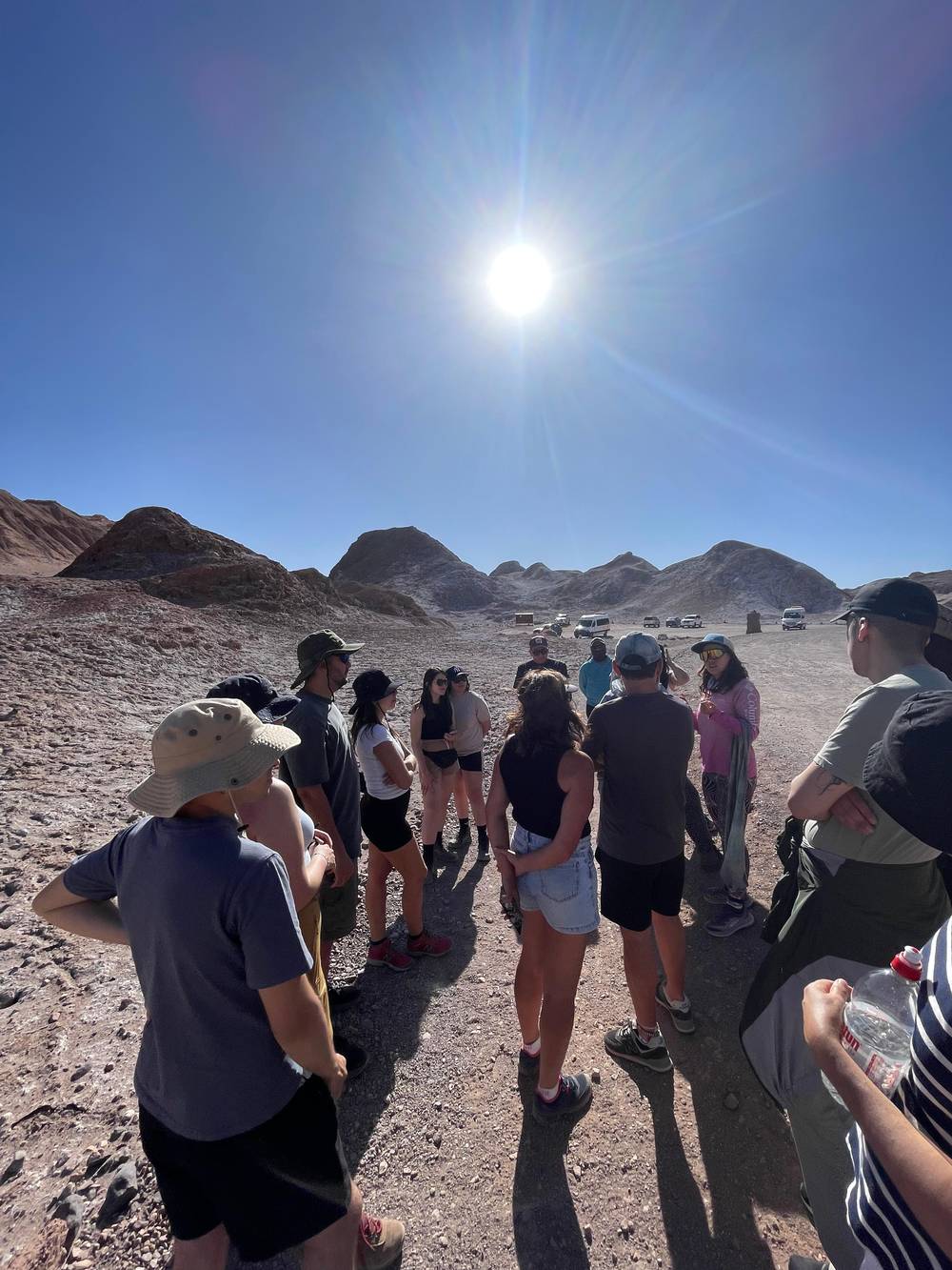
Phaneendra Medida on YouTube · Your tap on play is what loads the video.
The trails are clearly signposted, and it is strictly forbidden to cross their limits.
On the road in
The last stop of the valley is the Ckari viewpoint, which Chile Travel calls the final route of Valle de la Luna; rangers set the number of visitors and each group may stay 60 minutes.23 By CONAF's measure the path up is 350 m long, a 40-minute outing.19 The official ticket page gives it its own winter hours, from 10:00 to 19:00.51
Tours end their afternoon around here. The site tour's last stop is the Mirador de Kari and Piedra del Coyote pairing, where it spends 40 minutes, before a 15-minute drive to the square in town. Independent visitors should come early: the guided vans arrive in numbers for this lookout.52
Before this ridge, the tour sold here drives on from the inner trails to a 40-minute cocktail break at a separate stop it keeps secret; alcohol is not allowed inside the reserve, so drinks never belong on the trails.53 That rhythm, short walks in the heat and a long pause before dusk, is a good model for your own visit even without a guide: save energy for the last hour, because the light is the reason you came.
Not every tour sees the same valley. The tour sold on this site combines the Tres Marias, a viewpoint walk of 40 minutes, the cocktail break and the sunset at Kari, in 4.5 hours with pickup, from $60. The shared tour of 4 hours starts from an address in town and centres on the great dune, ending with a 70-minute hike at sunset, from $35.
Small groups trade price for space: a 5-hour tour is limited to 14 participants and includes pickup, from $44, and its listing warns that it involves moderate walking. By bike, an e-bike tour of 3.5 hours takes up to 5 riders, with pickup, from $120; you need to know how to ride a bicycle.
If you want a specific trail, ask before you book: the listings name their main stops, but the exact order changes with crowds, closures and the season. Rules apply to everyone whatever the tour: no food or alcohol inside the valley,53 no stones or plants taken home,48 and every scrap of rubbish taken away or sealed in the bins of each sector.49
FAQ
It is a 15-minute drive: the access is 13 km out of town.1
CONAF does not allow entry on foot; you need a vehicle or a bicycle.2
CONAF gives it as 3 km and 3 hours.4
CONAF gives 45 to 60 minutes for the whole trail.16
The walk lasts up to 15 minutes with at most 24 people on the trail.21
CONAF shuts them in sandstorms and in summer rain.28
Sources
Continue reading
Planning a sunset in the Valle de la Luna? Ask a real person.